
 WAND TV
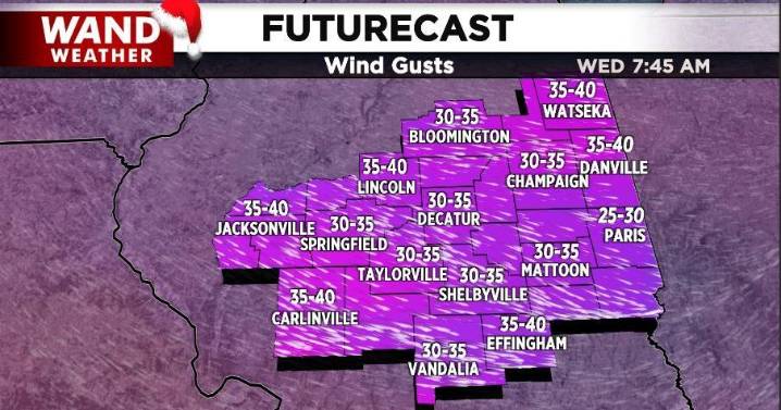
DECATUR, Ill. (WAND) - The first clipper storm of the week is history outside of a passing flurry tonight. Its associated wind, which tipped the scales at 58 mph in Springfield, is also on the wane tonight. However, the cold air arriving is only the tip of the iceberg.
A pocket of drier air above our heads arrives with the colder weather tonight. That means, our next clipper will have to fight off that drier air to eventually bring accumulating snow our way. That will happen, but not until later Thursday. Any flurries before 5 pm will be limited. The true accumulation will be shortly thereafter. The storm track will be oriented west-northwest to east-northeast. That's a given. The question mark is where the heavier band of 3-5" accumulation sets up. Right now, the WAND weathe

 ABC News
 ABC News Weather
 KNOE
KNOE 13 On Your Side
 WILX News 10
 CBS Sacramento Dixon News
 KCTV5 News
 The Columbian
 AlterNet
 Raw Story