
 KWWL
KWWL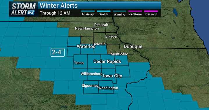
Tonight [WINTER WEATHER ADIVOSRY through midnight]: Snow moves southeast through the evening hours. This will make the roads slick. The more likely chance of snow is south of a line from around Waterloo to Monticello (1-3” with isolated 4” amounts). Areas north of that line should have flurries or a brief snow shower and little to no snow accumulation. Low: 11-17. Winds: E 5-10 mph.
Friday: Cloudy. High: 21-25. Winds: NW 10-20 mph. Some blowing snow in open areas. Wind Chills: 10-20.
Friday Night: Mostly cloudy and colder. Low: -3 to 4 Winds: NW 10-15 mph. Wind chills: -20 to -10.
Saturday: Another round of snow. Starts around sunrise and tapers off close to sunset. This is also looking like another 1-3” of snow. It looks like it will fall in roughly the same area as Thursday.

 ABC News
 ABC News Weather
 KOLR10 News
 KNOE
KNOE WAND TV
 KGNS
KGNS The Gazette
 NECN Providence
 K2 Radio Local
 CNN Politics