
 KFVS12
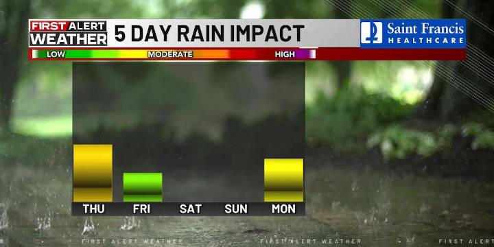
(KFVS) - A couple of cold fronts will be moving through the Heartland over the next few days, cooling temperatures down but also bringing rain and even thunderstorm chances.
Today will be warmer and more humid with afternoon highs ranging from 85 to 90 degrees and dew points near or above 60.
Heat index numbers will be around 90 degrees by this afternoon, but changes are on the way.
The first cold front will move into the Heartland overnight with increasing clouds and a broken line or two of showers.
Severe storms are not outlooked, but there could be enough instability for some thunder and lightning.
Rain chances look to range from about 70 percent in our northeastern counties in southern Illinois to about 30 percent in southeast Missouri, including the Bootheel.
Some locations may

 WLWT
WLWT The Bay City Times
 93 WIBC Indianapolis
 The Washington Post
 The Oregonian Public Safety
 WCBI-TV
 WXYZ Detroit
 NewsChannel 5 Nashville
 FOX 11 Riverside County
 KSNB Local4 Central Nebraska
 CNN
CNN