
 KGET 17 News
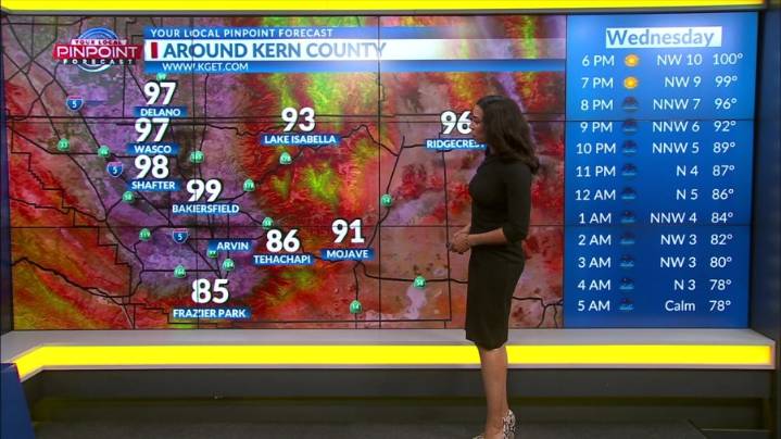
BAKERSFIELD, Calif. (KGET) -- While Thursday and Friday expect to see near triple digit temperatures, a cooling trend is expected to begin this Friday through at least early next week, with highs dipping below the normal temperatures expected at this time of year.
A small disturbance off the coast of California continues to supply a small amount of moisture to the region, resulting in the further chances for thunderstorms Wednesday afternoon as well as Thursday.
Current probabilities for development are between 10-25%, with the highest chances along the Sierra Nevada crest, increasing northward.
These storms also have a smaller chance of producing dry lightning as the relative humidity at the surface has improved in that area since Tuesday.

 Associated Press US News
 Arizona Republic
 KCRA News
 NBC 7 San Diego Local
 Santa Maria Times Local
 Los Angeles Times
 NBC Southern California Local
 FOX News
 Mission Local
 FOX 5 San Diego
 Nola Sports