
 WWSB
WWSB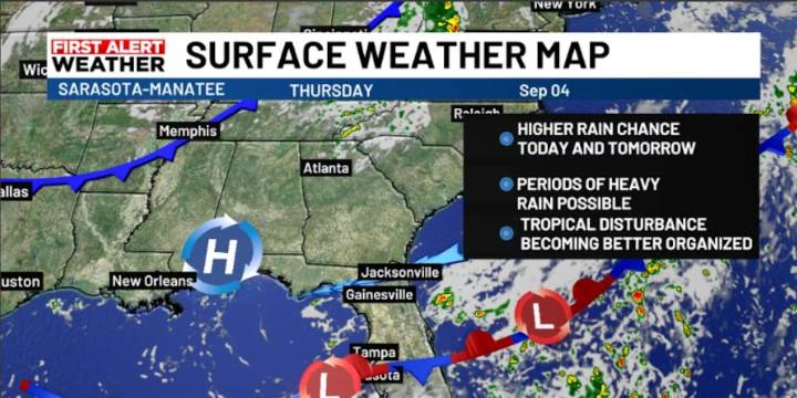
SARASOTA, Fla. ( WWSB ) - The low-pressure system in the Atlantic, off the southeast coast of Florida, is moving away. That low has been holding back our rain by creating a broad area of dry, sinking air. Now, more showers are on the way.
Today, the cold front to our south will push closer to the I-4 corridor and help spark rain and storms on the Suncoast. Some showers may start along the coast in the morning, with more scattered storms developing in the afternoon and evening. The threat for heavy downpours is greatest on the east coast of the state and to the south; however, the Weather Prediction Center includes most of the Suncoast in the marginal risk zone for excessive rain today.
By Friday, the front slides farther south once again, leaving most of the rain over South Florida whi

 FOX 13 Tampa Bay Crime
 First Coast Crime
 Florida Today
 The Newport Daily News
 New York Post
 KLCC
KLCC NBC 7 San Diego Local
 First Coast News
 FOX 5 Atlanta Crime
 New York Daily News Politics