
 FOX Weather
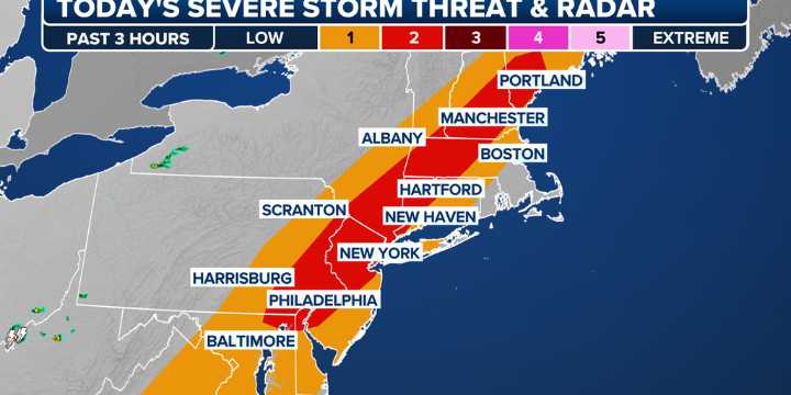
BOSTON - Showers and thunderstorms are likely along the Interstate 95 corridor Saturday as a stout cold front sweeps through the eastern United States, bringing the threat of damaging winds and hail.
The Storm Prediction Center has placed much of the corridor under a slight risk for severe weather, stretching from eastern Pennsylvania and Maryland into southern New England.
While showers may develop during the morning, the FOX Forecast Center says heating during the afternoon will likely trigger the bulk of the heavier activity.
The stronger thunderstorms will be capable of producing wind gusts up to 70 mph as well as some small hail.
WAVES BATTER MICHIGAN LIGHTHOUSE AS POWERFUL COLD FRONT SWEEPS THROUGH
The SPC, in coordination with local National Weather Service offices, has the cap

 The Boston Globe Crime
 SouthCoastToday
 The Babylon Bee
 FOX News Videos