
 WWSB
WWSB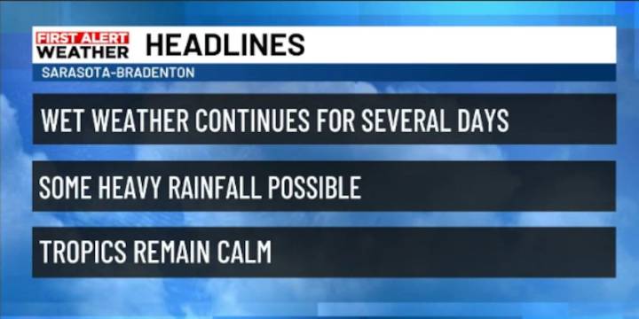
SARASOTA, Fla. (WWSB) - A broad area of low pressure sitting less than 100 miles offshore and a stalled front across North Florida will keep conditions unsettled through the end of the week. The low is not tropical in nature; however, it is tapping into large amounts of tropical air moving in from the south. The stalled front will crawl through on Thursday and park in South Florida, and the low will wash out on Wednesday. So, the long and short of it all is that the atmosphere currently has a three-pronged attack on the stability of our weather which will last until Friday.
On the Suncoast today expect mostly cloudy and muggy weather with occasional showers, lingering into the overnight and into the day tomorrow. Inland and southwest Florida will see more sunshine bringing higher temperat

 Florida Politics
 FOX 13 Tampa Bay Crime
 Orlando Sentinel
 WFLA Hillsborough County
 KY3
KY3 FOX 35 Orlando
 News4JAX
 First Coast Crime
 Raw Story