
 WSIL-TV
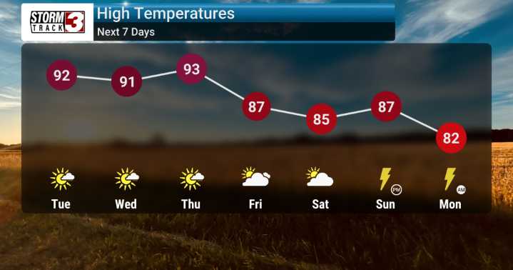
it looks like we’re in for another warm stretch across the Tri-State area as we kick off our week. We're tracking a strong ridge of high pressure that's going to keep us under generally clear to partly cloudy skies for much of today and tomorrow, with temperatures soaring.
Expect highs to really climb into the low to mid-90s through Wednesday. Now, for this time of year, our normal highs are typically in the low to mid-80s, so we are definitely looking at conditions that are running warmer than average, by about 7 to 10 degrees higher!
The good news is that while it will feel quite warm, our humidity levels aren't expected to be oppressive. We’re seeing dewpoints in the 60s, which means the feels-like temperatures, or heat indices, will be pretty close to the actual air temperatures. We
 WSVN 7 News
 AccuWeather Severe Weather
 Week | 25 News Now
 NBC 6 South Florida
 Raw Story
 IndyStarSports
 FOX News
 New York Post Video
 The Babylon Bee