
 21Alive News
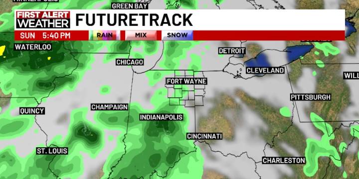
FORT WAYNE, Ind. (WPTA) - Today continued the stretch of warm late-summer temperatures across Northern Indiana and Northwest Ohio! After a bit more patchy fog Thursday morning, midday temperatures will rise into the mid to upper 80s once again.
Friday will likely be no different, but Saturday and Sunday look a couple of degrees cooler with highs in the low to mid (versus mid to upper) 80s.
Late Sunday into Monday a slow-moving front will bring increasing clouds and chances for showers/few rumbles of thunder. These showers could linger into Tuesday as well, though overall rainfall amounts still look pretty light! From Sunday night through Tuesday night, 0.25″ to 0.50″ of rain is possible across the area.
Still no signs of a significant cool down in the next week or two!

 The Atlantic
 The Star Press
 Associated Press Elections
 MSNBC
MSNBC AlterNet