
 FOX Weather
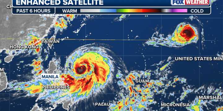
Typhoon Ragasa continued to intensify over the weekend in the western Pacific, raising concerns that some communities in Southeast Asia could face a super typhoon over the next week.
The cyclone, known in the Philippines as "Nando," reached typhoon status on Saturday and was expected to reach the equivalent of a Category 4 hurricane by the start of the workweek.
Satellite imagery showed a distinct eye had formed before the cyclone moved into the Luzon Strait, between the Philippines and Taiwan.
The worst of the weather was expected to stay south of Taiwan but clip the northern Philippines as the system is forecast to move westward into the South China Sea.
Satellite observations estimated that water temperatures are in the range of 82–88 degrees Fahrenheit ahead of the cyclone, which i

 NPR
NPR Redlands Daily Facts News
 Newsday
 Arizona's Family
 Raw Story
 AlterNet
 US Magazine