
 The Jersey Journal
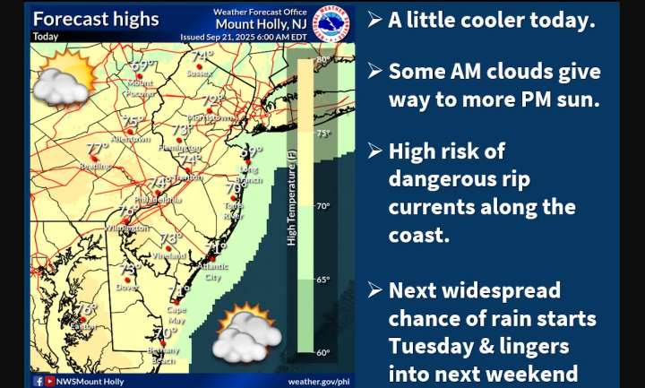
The chances of showers and potential thunderstorms starting Tuesday afternoon have increased in the latest forecast in what could be a stormy week for New Jersey.
Ahead of the storms, the current stretch of pleasant weather will continue Sunday and Monday.
Temperatures will remain mild, with highs in the 70s today and climbing to around 80 degrees inland on Monday.
Coastal areas will see slightly cooler temperatures, staying closer to 70 degrees.
Early morning hours will feature low clouds that should break up by afternoon, leading to mostly sunny conditions.
For those getting in some beach time before the official end of summer on Monday , the National Weather Service has issued a high rip current risk for coastal New Jersey zones through Monday evening.
Winds will be easterly at

 FOX 10 Phoenix Latest
 KSNB Local4 Central Nebraska
 NECN Providence
 Florida Today
 WBRC
WBRC Dickson County Source
 FOX19 NOW
 The Washington Post
 New York Post