
 WAFB
WAFB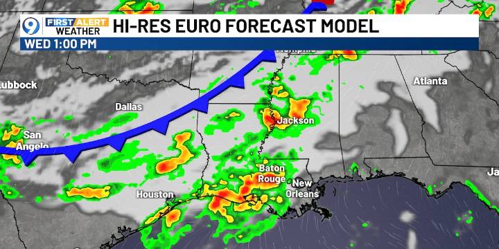
BATON ROUGE, La. (WAFB) - Today marks the official start of fall, but summer-like warmth and scattered storms stick around until a midweek cold front brings higher rain chances and cooler temperatures to close out the workweek.
TODAY’S FORECAST
A quiet and dry morning will give way to another warm afternoon with highs in the low 90s. Scattered showers and storms are expected to develop by the afternoon and linger into the evening.
ELEVATED RAIN MIDWEEK
Rain chances increase midweek as a cold front pushes through the region by Wednesday into Thursday. Scattered to numerous showers and thunderstorms are likely ahead of the boundary.
SEVERE WEATHER THREAT
A few storms could become strong to severe ahead of the cold front, primarily on Wednesday. The Storm Prediction Center (SPC) highlig

 Idaho News 6
 WDHN News
 WCTV
WCTV KSLA News Crime
 Nola Crime
 The Advocate
 KSLA News
 Reuters US Top