
 WAAY TV
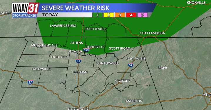
The first week of fall brings us 3 consecutive days of stormy weather. Monday-Wednesday all feature a marginal 1/5 risk to see some strong to severe storms.
Today's marginal risk includes areas of the Tennessee Valley that are north of the Tennessee River. These storms will start to pop up around lunch time, and will last into the evening. Gusty winds, heavy rainfall and lightning will be today's threat.
Tuesday's risk is a lot like todays, more focusing on the most northern part of our viewing area. Same threats are in place from Monday, as will also be spotty in nature.
Wednesday's will be more widespread, and will pretty much last the whole day. The severe weather threat covers our whole coverage area, and the same threats will apply; heavy rainfall, gusty winds, and plenty of light

 WAVE 3 News
 LEX 18 News
 WRCB-TV
 KSLA News
 The Mercury News
 KCCI 8
 FOX 32 Chicago
 FOX 61 Weather
 News on 6
 KRIS 6 News Weather
 ABC News Weather
 FOX News
 The Fashion Spot