
 WWSB
WWSB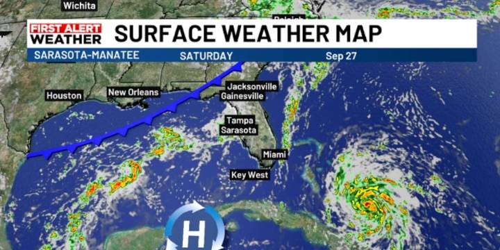
SARASOTA, Fla. (WWSB) -Through the end of the week, and into the weekend, a low-pressure system aloft will move across the Deep South with its cold front surface reflection inching toward Florida. This somewhat innocuous feature could end up being very important in the future path of a developing tropical disturbance likely to be in the Bahamas by the weekend.
Today that front will help weaken high pressure centered over Florida and shift it southward. This changing setup will keep surface winds light, generally out of the east today, with afternoon sea breezes that will trigger late day storms.
By Friday, winds will begin to shift more westerly as the high continues to settle southward, setting up a typical pattern where showers and storms form over the Gulf and coastal areas late at ni

 Breitbart News
 FOX 13 Tampa Bay Crime
 WESH 2 News
 First Coast News
 NBC News
 ClickOrlando