
 Reno Gazette-Journal
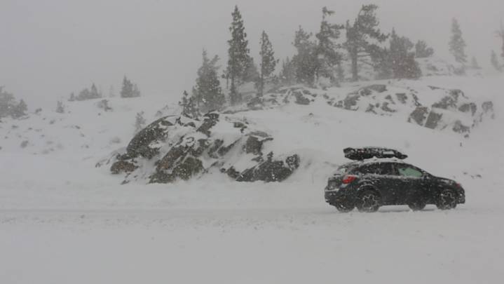
A cold Pacific system moving in early next week could bring the season’s first significant Sierra snow and rain in lower elevations.
The National Weather Service has issued a winter storm watch for the Tahoe Basin and Mono County from 5 p.m. Monday, Oct. 13, through 11 a.m. Wednesday, Oct. 15. Forecasters say 6 to 12 inches of snow are possible above 7,000 feet, up to 2 feet along the Sierra crest and 1 to 3 inches at the lake, depending on the storm’s final track.
While confidence has increased in snow for higher elevations, forecasters said the system’s exact path will determine whether heavier snow crosses into the Tahoe region or stays mostly west.
The weather service said the highest snow potential is currently favoring Mono County along the crest, with sufficient risk of winter tr

 America News
 NBC News Video
 KSNB Local4 Central Nebraska
 Post Register
 The Fayetteville Observer
 KTVU San Francisco
 CBS Los Angeles
 WBRC
WBRC The List