
 WAFB
WAFB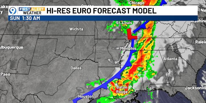
BATON ROUGE, La. (WAFB) - The weather looks warm and dry through Friday, then storms expected this weekend as cold front approaches.
Today will be a nice, dry, sunny, and warm day with highs in the upper 80s. No rain expected the next 24 hours under high pressure, but moisture will start to increase.
The EURO model shows the possible timing of the incoming weekend cold front, which will move storms, some strong, through the area Saturday afternoon through Sunday morning.
The SPC has our region in a level one marginal risk for strong to severe storms with a higher threat in the northern part of the state. Damaging winds would be the primary concern, but again, it looks like the severe threat will mainly be to the north of our viewing area.
By Sunday morning, the front will move through,

 WWSB
WWSB KTAB
KTAB WSIL-TV
 Nola Crime
 WDSU New Orleans
 Raw Story