
 WREX
WREX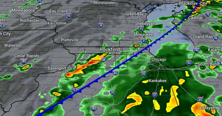
An active forecast is in store for the weekend as a classic Midwestern fall pattern of breezy and wet weather is shaping up.
Skies clear out briefly for tonight, but temperatures won't cool off all that much as a warm front lifts across the Great Lakes. That will keep temperatures in the mid 50s tonight and help us soar into the upper 70s with perhaps some 80° readings Friday afternoon.
Cloudy skies return on Friday, but we are holding dry but windy during the daytime hours. Gusts may peak around 30 mph in the afternoon.
Occasional showers and thunderstorms will be drifting through the area just about all day Saturday through Sunday morning. Coverage will be more scattered on Saturday before more widespread soaking rain comes in on Sunday. Rain and clouds will gradually clear up from we

 WEVV 44News
 WSIL-TV
 WBRC
WBRC MyNorthwest
 FOX 32 Chicago
 KFOR
KFOR KWTX News 10
 FOX 10 Phoenix Latest
 FOX 13 Tampa Bay Crime
 FOX Weather
 Raw Story