
 WBKO
WBKO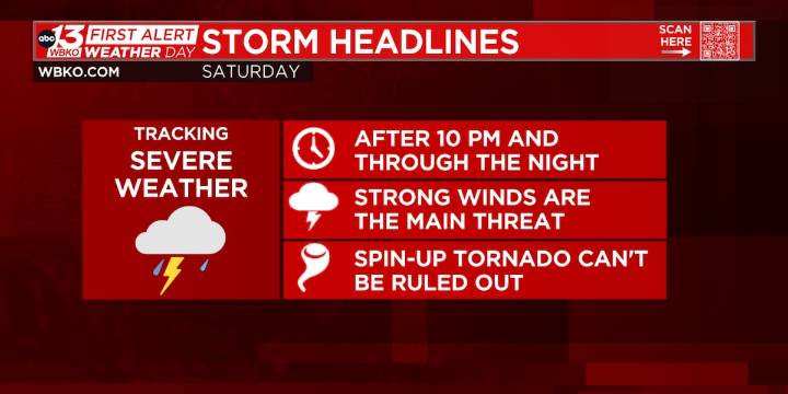
BOWLING GREEN, Ky. (WBKO) - We were one degree shy of breaking the record high in Bowling Green today. Severe storms are possible tonight as a cold front moves through the region. The timing of the threat looks to be after 10 P.M. Saturday night.
SATURDAY NIGHT (FIRST ALERT WEATHER DAY): There is a risk for stronger winds as a line of storms moves into the area. An isolated spin-up tornado is not out of the question. Additionally, expect heavy rain.
The First Alert Weather Day will run from 10 P.M. Saturday night until early Sunday morning.
The “better” chance for severe weather is west of I-65 where the Slight Risk, level 2 out of 5, is in place. All other areas are in a marginal risk, level 1 out of 5.
As always, have a way to get alerts if a severe storm were to move through your

 KWTX News 10
 KXXV
KXXV KCEN TV
 America News
 New York Post
 KIMT News 3
 KSNB Local4 Central Nebraska
 KKTV 11 News
 WCPO 9
 Hawaii News Now
 KTAL-TV
 Santa Maria Times Local