
 Orlando Sentinel
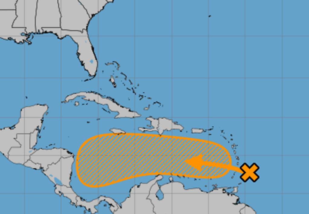
The National Hurricane Center on Sunday increased the chances a Caribbean-bound system will develop into the season’s next tropical depression or storm.
As of the NHC’s 8 a.m. tropical outlook, the tropical wave, dubbed Invest 98L, was approaching the Caribbean’s Windward Islands with a large area of showers and thunderstorms.
“Heavy rainfall and gusty winds are expected today continuing through Monday morning across portions of the Windward and Leeward Islands as the system moves quickly westward at 20 to 25 mph into the eastern Caribbean
Sea,” forecasters said. “Additional development is forecast to be limited over the next day or two, due to the fast forward motion of the wave.”
The system is forecast to slow over the central Caribbean Sea midweek, though.
8am EDT 19 Oct – NHC is m

 NOLA
NOLA ClickOrlando
 WGNO
WGNO America News
 New York Post
 KIMT News 3
 KSNB Local4 Central Nebraska
 KKTV 11 News
 FOX 5 Atlanta Crime
 News Channel 36
 WDSU New Orleans
 Essentiallysports Motorsports