
 WAFB
WAFB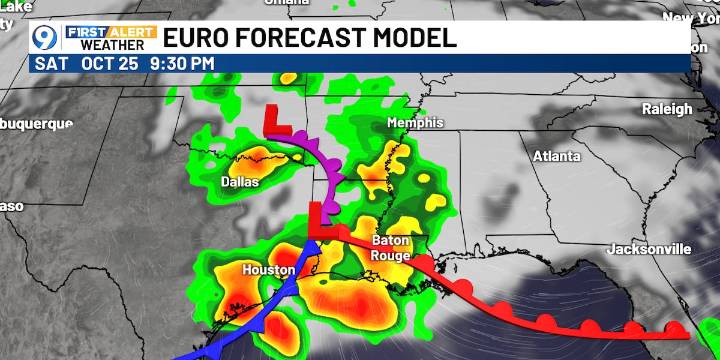
BATON ROUGE, La. (WAFB) - Friday will be nice and dry, but wet weather associated with a low-pressure system and cold front will move through the region over the weekend.
FRIDAY’S FORECAST
Today will be nice and dry with a cool start and a warm finish. It could be a bit breezy in the afternoon, otherwise a nice way to close out the work week before this weekend’s story weather arrives.
COMPUTER MODELS
The EURO model shows the possible timing of showers and storms this weekend. An area of low pressure and associated cold front will move through late Saturday into Sunday. Rain chances will start Saturday morning and end Sunday afternoon.
SEVERE STORM OUTLOOK
There is a level two slight risk of severe weather this weekend, more specifically, from Saturday afternoon through early Sunday

 News Collection
 The Daily Beast
 Local News in D.C.
 AlterNet
 TheFashionCentral
 The Babylon Bee
 AmoMama
 CBS News