
 News 19 WLTX
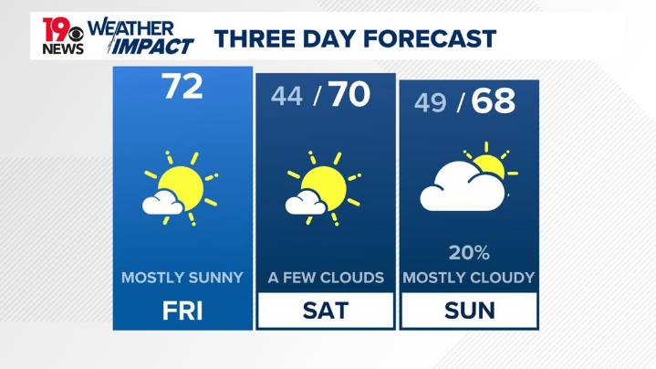
COLUMBIA, S.C. — An extended stretch of dry weather continues across the Midlands, with near- to slightly below-normal temperatures expected through the weekend. The next chance of rain is not expected until late in the weekend, when a more unsettled pattern begins to take shape. Rain chances will return by late Sunday night and continue on and off through much of next week.
Early this morning, a weak reinforcing cold front is sliding through the area, shifting winds from the southwest to the northwest and bringing another dose of dry, cool air.
Temperatures started off in the low to mid-40s, with some sheltered areas dipping into the upper 30s. High pressure will build overhead through the day, keeping skies mostly clear and winds light out of the northeast.
Afternoon highs will top

 FOX Carolina
 The Daily Bonnet
 Local News in D.C.
 CNN
CNN Cover Media
 SOFREP
 Essentiallysports Combat Sports
 Women's Wear Daily Retail