
 WAAY TV
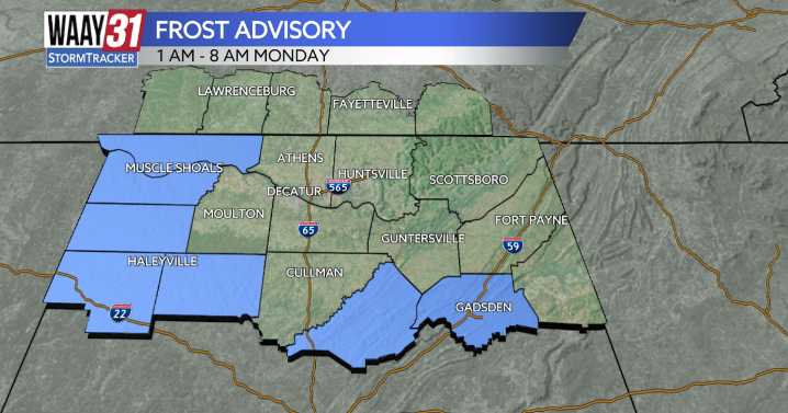
** FROST ADVISORY FROM 1 AM - 8 AM MONDAY **
For the rest of the evening, temperatures will gradually drop out of the 40s and into the mid to upper 30s for overnight lows. Lingering cloud cover will remain across areas east of I-65, while skies will be clear toward the Shoals, prompting a Frost Advisory for the morning.
Monday morning will start off chilly, but by the afternoon, temperatures will warm into the low 60s under partly cloudy skies.
A gradual warm-up is expected through the rest of the week, with highs reaching the low 70s by Wednesday. Overnight lows will also warm into the mid 40s.
Dry conditions will continue through much of the week, but rain chances return by Friday as a cold front moves in. TONIGHT: Chilly, frost advisory in effect. Wind: Calm MONDAY: Partly cl

 WITN-TV
 Queen City News
 Northern News Now
 WHAS 11
 KTVU San Francisco
 KSNB Local4 Central Nebraska
 Battle Creek Enquirer
 KNOE
KNOE WILX News 10
 The Bay City Times
 Courier Journal
 Vulture