
 WRCB-TV
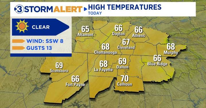
It’s another Tuesday afternoon here in the Tennessee Valley. Temperatures will remain warmer than average through the next few days. Highs today will likely reach the mid-upper 60s. Lows will drop into the 40s tonight.
Sunshine and dry weather will continue for several days. High temps will even push into the 70s through Friday. A cold front will bring our next solid chance for rain on Friday afternoon/evening. Widespread rain will be possible across large portions of the viewing area. Rain showers are also possible through Sunday.
Rain accumulation as of today ranges between 0.25” and 0.5”. Once the cold front passes, temperatures will dive. Lows will drop to, if not below, freezing across the lower elevation areas, while the highest elevations will fall into the 20s.
Model

 FOX 13 Seattle King County
 KIMT News 3
 Eyewitness News 3
 KTLA
KTLA KSNB Local4 Central Nebraska
 KKTV 11 News
 KPAX
KPAX K2 Radio Local
 FOX 13 News
 FOX 32 Chicago
 AlterNet