
 ABC4 News
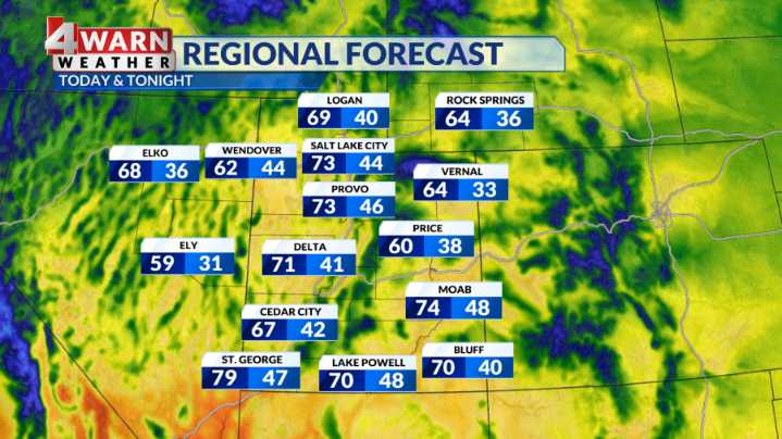
SALT LAKE CITY (ABC4) — Happy Wednesday, Utah! Our Wednesday afternoon will feature breezy southwest winds ahead of our next weather maker.
Scattered clouds will begin to increase Wednesday afternoon but we should mainly stay dry on Wednesday. Highs will warm into the lower 70s for the Wasatch Front and into the upper 70s for SW Utah.
The cold front will graze past northern Utah late Wednesday night into Thursday morning, bringing a chance for showers for areas along and north of I-80. Right now, areas south of Utah county look to remain dry with this frontal passage. Most areas north of I-80 are looking at only around a 0.10" of rain possible. Some locations closer to the Bear River Range could pick up near a 0.25" but not expecting a big rain event with this one.
Snow levels will dip

 KSL 5 TV
 Deseret News
 The Babylon Bee
 Dakota News Now Sports
 AlterNet
 PupVine
 The Daily Bonnet
 Essentiallysports Combat Sports
 The Daily Beast