By Joe Lombardi From Daily Voice
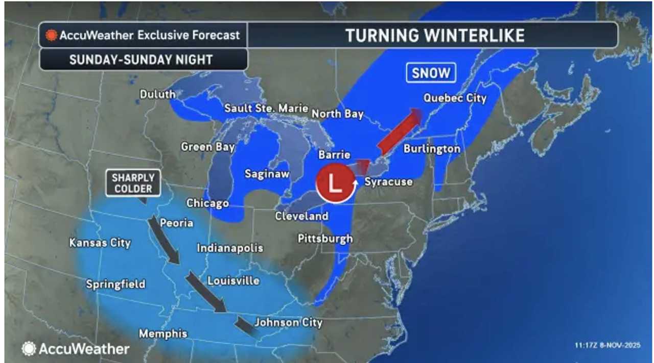
A blast of cold air will bring the first snow of the season to parts of the interior Northeast early next week, marking the arrival of winter weather for many areas.
The drop in temperatures, combined with lake-effect snow, is expected to create hazardous travel conditions and accumulating snowfall in some locations.
The coldest air of the season so far will plunge into the Midwest and Northeast beginning Sunday night, Nov. 9, and continue through Tuesday morning, Nov. 11, according to AccuWeather.
Some areas may see a rain-snow mix or wet snow that melts on contact, but where snow bands persist, several inches of accumulation are possible.
While the I-95 corridor, including cities like New York City, Philadelphia, and Washington, DC, is not expected to see accumulating snow, a stray snow shower cannot be ruled out.
“Winter coats and snow shovels may be needed across the interior Northeast into early next week as the coldest air so far this season sets the stage for multiple rounds of snow,” AccuWeather meteorologists said.
However, areas farther inland could face slushy roads and localized travel disruptions, especially during the overnight and early-morning hours.
The National Weather Service warned that the first snow of the season often catches drivers off guard.
“While lots of snow in the middle of winter can certainly cause dangerous travel conditions, many times it’s the FIRST snow of the season that can cause accidents," the agency said in a statement. "Be extra careful as you and other drivers adjust to driving in poor conditions. Slow down, don’t use cruise control, and keep your distance from other vehicles."
The snowiest spots from this weekend through Tuesday could see several inches of accumulation, with the potential for heavy snow in areas where lake-effect bands persist.
This will be the first widespread wintry event for many locations, offering an early reminder of the challenges winter weather can bring.
The cold spell is being driven by a big dip in the jet stream, which is allowing Arctic air to surge southward.
An Alberta clipper system is also expected to bring snow to parts of the Midwest, including South Dakota, Michigan, and southern Ontario, before the cold air spreads eastward into the Northeast.
Even where snow does not accumulate, heavy snow showers could cause airline delays due to deicing operations, particularly in the interior Northeast and Upper Midwest. Travelers are advised to monitor forecasts and prepare for potential disruptions.
Check back to Daily Voice for updates.

 Daily Voice

 New York Post
 WNNY-TV
 ABC 7 NY
 Newsday
 Raw Story