
 21Alive News
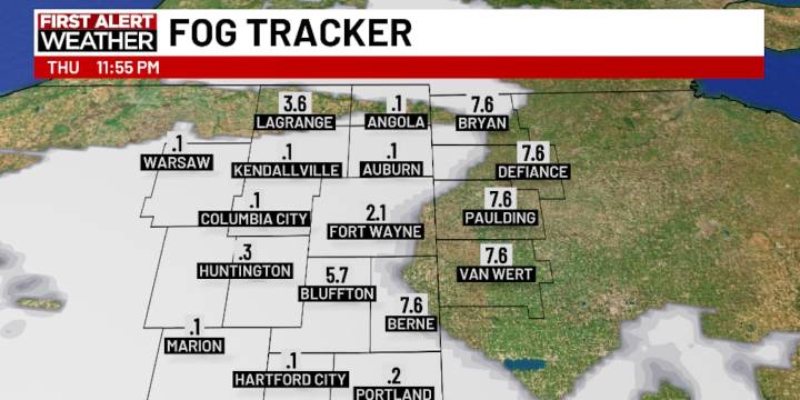
FORT WAYNE, Ind. (WPTA) - One of the consequences of a stagnant pattern such as the one we are in is the development of fog.
Low clouds and mist have largely kept temperatures cooler than expected today, and Friday’s high temperature has reflected that trend: A once-possible mid-50º high now looks more like a stretch, with barely hitting 50º a more likely outcome. But a little bit of clearing overnight is likely to encourage some fog development with visibility potentially near or below one mile from 10 pm tonight through 6 am Friday.
A large weather system to our south could bring some light and scattered rain showers to the region late Friday afternoon into the evening, but amounts will likely be as minimal as what was experienced Tuesday. Still, keep that umbrella handy if you’re goin

 WSMV 4 Nashville
 WRCB-TV
 Bozeman Daily Chronicle
 Bustle Relationships
 The Conversation
 CourierPress Sports
 KCRG Iowa
 New York Post Opinion
 @MSNBC Video
 RadarOnline
 MSNBC
MSNBC