
 News Channel 36
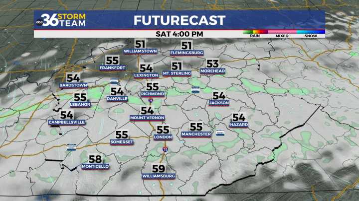
We'll finally see a return of some sunshine, especially on Sunday It’s been a damp and dreary stretch of weather the last few days here in Central and Eastern Kentucky and Friday was no exception. With a frontal boundary laid out across the commonwealth and a wave of low pressure sliding in from the west, we saw another day of scattered rain and a few rumbles of thunder. Temperatures varied once again with locations south of the boundary jumping into the 60s while areas north mainly stayed into the 50s for afternoon highs.
The wet weather will finally come to an end heading into the weekend as the area of low pressure quickly transitions off the southeast. While the rain chances wind down, we could see some stubborn cloud cover linger for a bit as we roll through Saturday. Look for morni

 WFMJ-TV
 Daily Voice
 KSNB Local4 Central Nebraska
 AccuWeather Severe Weather
 Deseret News
 The Hill
 AlterNet
 RadarOnline
 WJLA
WJLA People Top Story