
 KIMT News 3
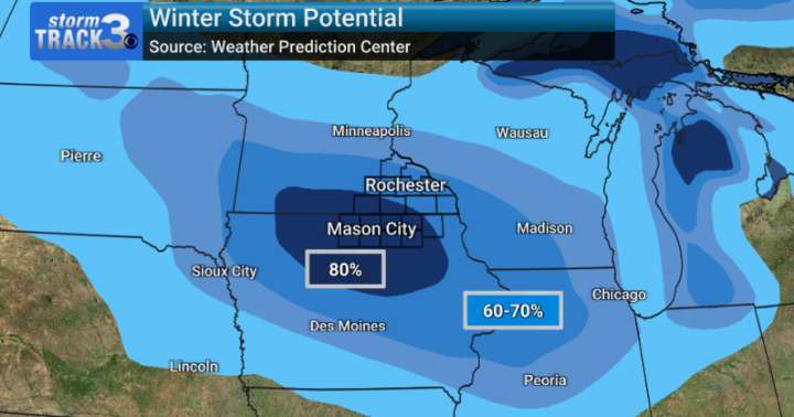
As much of the area is still feeling the effects of our last winter system, another impactful storm is looking to bring another round of travel headaches to the Upper Midwest region this weekend.
Starting Friday night and lasting thought Saturday night, this organized system has the potential to bring plowable snow to our area. As of Wednesday evening, Rochester's probability of seeing six or more inches of snow was around 90%, with similar numbers seen across the majority of our area (including North Iowa).
The exact track of the storm is still unclear and will ultimately dictate where the heaviest of the snow falls. Exact start and end times for this snowfall is also unclear so far out, but confidence is high that we will see at least six inches of fluffy snow over a 36 hour period.
A

 Daily Voice
 CNN Climate
 Associated Press US News
 Detroit News
 The Oregonian Public Safety
 NBC News
 AccuWeather Severe Weather
 WISC-TV Channel 3000
 KGNS
KGNS ScienceAlert en Español