
 ABC57 News
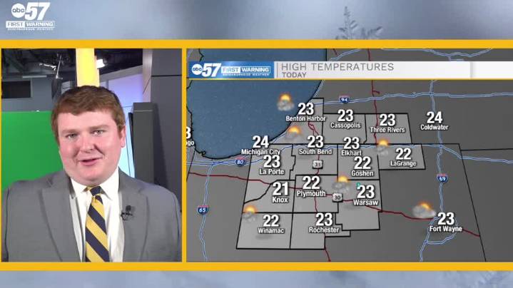
To view this video please enable JavaScript, and consider upgrading to a web browser that supports HTML5 video
We're starting off our Monday in the single digits this morning with many communities falling near zero degrees by 7 to 8 AM. A frigid airmass left behind by an upper level trough this weekend will keep temperatures contained to the mid 20s today and tonight, but a bump in temperatures into the 30s is on the way starting tomorrow courtesy of a weak ridge axis moving over the Great Lakes. Quickly after the ridge, a new surface low crosses toward our area and brings mixed precipitation on hump day that will likely result in freezing rain. Expect moderate to high weather impacts on you morning and evening commute Wednesday due to slick roads and a thin layer of ice or black ice. Te

 Local News in Illinois
 America News
 1011 Now Lincoln
 WCBI-TV
 The Seattle Times
 Hawaii News Now
 KSNB Local4 Central Nebraska
 WWSB
WWSB WKYT
WKYT