
 KIOW
KIOW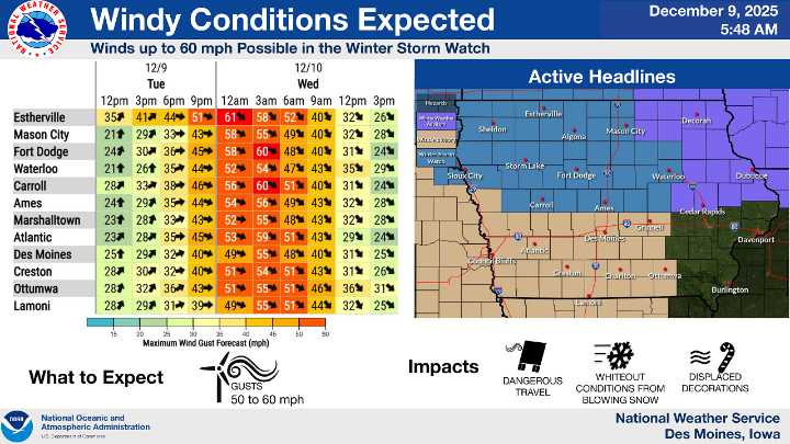
A powerful wind-driven winter system is expected to move across Iowa late tonight into Wednesday morning, raising the risk of blizzard-like conditions and dangerous travel, according to the National Weather Service in Des Moines.
Forecasters say the main threat will be extreme winds capable of producing widespread blowing and drifting snow, even if new snowfall amounts are limited. Wind speeds will increase through Tuesday afternoon and evening, then peak overnight into Wednesday. Gusts of 50 to 60 miles per hour are possible, especially in areas under a Winter Storm Watch. A Wind Advisory has also been issued for the southern half of the state.
While much of Iowa will avoid significant impacts through early Tuesday afternoon, conditions are expected to deteriorate quickly late tonight.

 The Des Moines Register
 KTIV News 4
 ABC News
 ABC News Weather
 KNOE
KNOE NBC 6 South Florida
 CBS Sacramento Dixon News
 West Kentucky Star
 The Columbian
 13 On Your Side
 KBTX News 3
 WAND TV
 E Online