
 KFVS12
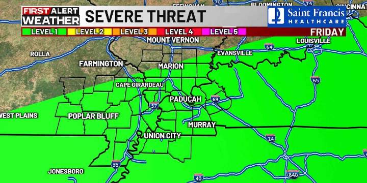
(KFVS) - A few showers could linger for a few hours this morning as a cold front moves out of the Heartland.
Some locations received little or no measurable rainfall with this system, as forecasted, but another, better chance for rain arrives Friday.
Clouds will move out throughout the day and it will be slightly cooler.
Afternoon highs will range from 76 to 82 degrees.
Temperatures will quickly rebound on Friday into the mid-80s as a strong cold front moves into the Heartland.
By late afternoon, some scattered showers and thunderstorms will be possible through Friday night.
Most of the Heartland is outlooked at a threat level 1 out of 5 for severe storms.
Stay tuned for updates on your First Alert Weather App !
The weekend is looking mainly dry and much cooler.
Highs on Saturda

 KTAL-TV
 WYMT
WYMT The Weather Channel
 KTVB 7
 KSNB Local4 Central Nebraska
 Joplin Globe
 WBKO
WBKO The Bay City Times
 New York Post
 FOX Weather
 Deadline
 FOX News Videos