
 The Oregonian Public Safety
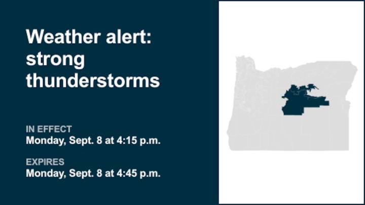
An updated weather alert was issued by the National Weather Service on Monday at 4:15 p.m. for strong thunderstorms until 4:45 p.m. for John Day Basin and Ochoco-John Day Highlands.
The storms may bring pea-sized hail (0.25 inches) and wind gusts of up to 40 mph.
"At 4:15 p.m., Doppler radar tracked a strong thunderstorm 13 miles southeast of Ashwood, or 19 miles west of Mitchell, moving north at 10 mph," comments the weather service. "Gusty winds could knock down tree limbs and blow around unsecured objects. Minor hail damage to vegetation is possible."
The weather service comments, "If outdoors, consider seeking shelter inside a building. Frequent cloud to ground lightning is occurring with this storm. Lightning can strike 10 miles away from a thunderstorm. Seek a safe shelter inside

 Florida Today
 FOX 13 Tampa Bay Crime
 Eyewitness News 3
 Times Herald
 WABI
WABI News 19 WLTX
 KMVT
KMVT Ionia Sentinel-Standard
 Ocala Star-Banner
 Nicki Swift