
 KIMT News 3
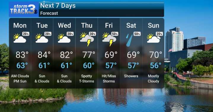
Some significant weather changes as we move through the week here in Southeastern Minnesota and Northern Iowa. We're starting off with what's essentially the tail end of summer, bringing us heat and humidity that's sticking around a bit longer than usual for this time of year. Highs to start the week will be climbing into the mid-80s. Humidity will also be quite noticeable, keeping those dewpoints elevated.
In terms of shower chances in the near term, tonight and Monday we'll be watching for a slim risk of isolated or scattered storms. While the severe weather threat remains low, these storms could contain some embedded heavy rain, potentially dropping an inch or two in a short period, especially if they move slowly or train over the same areas. Still, most spots will be dry.
The big shi

 KOAA News5
 WREX
WREX News 8 WROC
 WCBI-TV
 The Washington Post
 KETV NewsWatch 7
 WSIL-TV
 FOX Weather
 Vanity Fair
 NBC Southern California Entertainment
 CNN Politics
 AlterNet
 Raw Story