
 WBRC
WBRC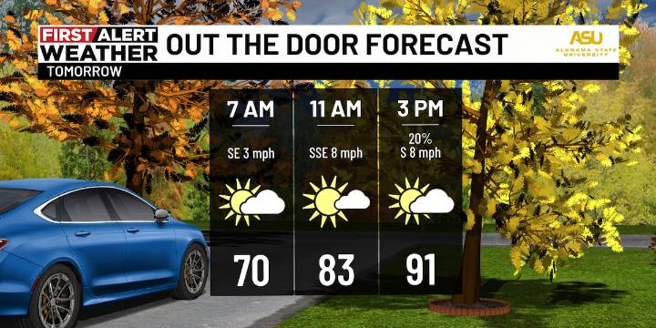
BIRMINGHAM, Ala. ( WBRC ) - Next 24 Hours: For your Sunday night, First Alert AccuTrack shows widely scattered showers lifting north across I-20 in Central Alabama. So, you may have some welcome raindrops to lull you to sleep! Monday will start off with temperatures mild in the upper 60s to low 70s with some patchy fog possible in the wake of today’s showers. Though tomorrow is the Fall Equinox, afternoon highs will still run very summer-like in the low to mid 90s. An isolated shower or storm could develop during the afternoon, but most of us will stay dry. Expect a “copy and paste” forecast for Tuesday.
Next Big Thing: We should finally see a pattern change later this week as a low pressure system moves eastward across the U.S. Rain and storms could move in as early as late We

 WKYT
WKYT WDAM-TV Crime
 Alabama Local News
 The Daily Mining Gazette Sports
 The Babylon Bee
 Raw Story
 ESPN Soccer
 New York Post
 Cover Media
 The Conversation