
 WHNT News 19
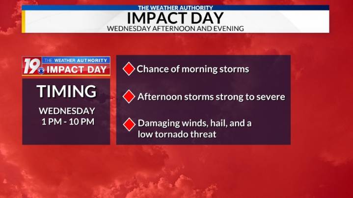
A Weather Authority Impact Day is in place for Wednesday due to the threat of strong to severe storms.
Storms that develop in the morning will pose a risk of torrential rainfall that could lead to ponding of water on roads. In the afternoon, ingredients become a little more favorable for damaging winds, hail and a low tornado threat. The threat of severe weather in the afternoon is conditional. If storms hang around for a while in the morning, then the risk of severe weather in the afternoon will decrease. If morning rain clears out early and/or we don’t see much, the risk will increase in the afternoon.
The approximate timeline for potential severe weather will be between 1 pm and 10 pm from west to east across the Tennessee Valley.
Stay alert to changing weather conditions. Download L

 11Alive
 KICKS 105
 AccuWeather Severe Weather
 FOX 5 Atlanta Crime
 KPTV Fox 12 Oregon
 KTVU San Francisco
 KRIS 6 News Weather
 KGNS
KGNS WFMJ-TV Entertainment
 ABC10 Video
 Joplin Globe Sports