
 WSMV 4 Nashville
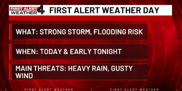
NASHVILLE, Tenn. (WSMV) - A First Alert Weather Day remains in effect due to the threat of localized flooding and strong wind gusts with some storms.
WEDNESDAY - FIRST ALERT WEATHER DAY
More rain is expected across Middle Tennessee and southern Kentucky today, and with already soaked ground, the risk of flooding is increasing.
The showers and storms will not be very organized this morning or during the first half of the afternoon, but even the spotty thunderstorms could produce heavy rain and gusty winds.
Our main round of rain will push in late this afternoon and through the evening with more widespread rain and thunderstorms. From 3-10 p.m., we’ll not only have the highest risk for strong storms, but this will also be the most likely time to see flooding in Middle Tennessee and s

 WBRC
WBRC FOX19 NOW
 Action News 5 Crime
 WVLT
WVLT The Motley Fool
 Newsweek Video
 TMZ
TMZ The List
 Raw Story
 News 9 Crime