
 The Jersey Journal
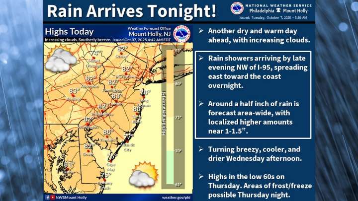
A strong cold front will bring rain and a significant temperature drop to New Jersey on Wednesday, marking the end of a warm spell and the start of much cooler autumn weather.
Showers are expected to develop overnight Tuesday and continue through Wednesday morning, with rainfall totals averaging between a half-inch to three-quarters of an inch across the state.
The precipitation will be accompanied by a big temperature shift, dropping daytime highs from the upper 70s and low 80s on Tuesday to the mid-60s to low 70s on Wednesday.
The National Weather Service forecasts northwest winds will become breezy behind the cold front, with gusts potentially reaching 25 to 30 mph.
These winds will contribute to the rapid cooling trend, with temperatures expected to fall significantly Wednesday aft

 Shore News Network
 GV Wire
 WWSB
WWSB KMVT
KMVT Eyewitness News 3
 WYMT
WYMT KBTX News 3
 KY3
KY3 KTIV News 4
 Sarasota Herald-Tribune
 Battle Creek Enquirer