
 KEZI 9 News
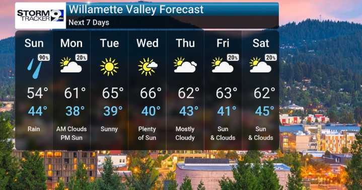
We have a lingering low-pressure system bringing us considerable cloudiness and occasional rain showers. We'll be monitoring just how much rain accumulates, with most locations seeing up to an inch of rain over the next few days, though the coast and mountains could see a bit more.
As we move through the week, we're expecting a transition. The initial rain chances will shift to more scattered showers, and by Sunday night, we're forecasting a shift toward drier weather thanks to building high pressure. This should help temperatures rebound, pushing our highs back into the 60s by Tuesday and Wednesday.
We're not anticipating any extreme cold or unusually heavy precipitation events, but we'll keep a close eye on the forecast models for any changes, especially towards the end of the week whe

 WJBF-TV
 NEWS10 ABC
 America News
 NBC News Video
 Post Register
 CBS Los Angeles
 KSNB Local4 Central Nebraska
 The Fayetteville Observer
 WBRC
WBRC Oh No They Didn't
 Essentiallysports Olympics
 The Babylon Bee