
 21Alive News
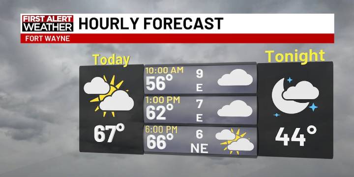
FORT WAYNE, Ind. (WPTA) - Skies stay cloudy for the majority of the day, but we’ll start to clear out a bit more by later this evening. A few isolated sprinkles are possible later this morning, mainly for areas north of US-30. Temperatures will only make it into the mid to upper 60s for Wednesday. We’ll hold onto the 60s for Thursday, but we’ll have more sunshine tomorrow.
Another cold front arrives this weekend. Our weekend front will pick up rain chances by Saturday evening, overnight, and into Sunday. Winds will start to pick up at times this weekend, with gusts looking to be up to 25 to 30 mph. We’ll see a sharp cut in temperatures for the weekend, starting out in the upper 70s on Saturday and back down into the low 60s by Sunday. The start of next workweek will be fairly cool with mo

 Massillon Independent
 RadarOnline
 The Cut
 Page Six
 The Hill Campaign
 Mediaite
 America News
 AlterNet