
 WVEC
WVEC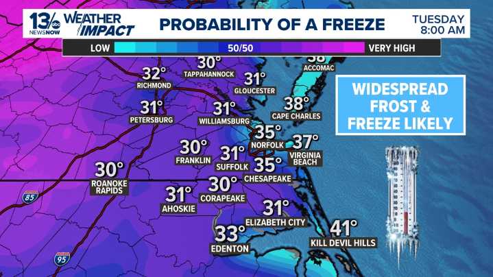
NORFOLK, Va. — We’re heading into a big weather pattern shift over the next few days. While this weekend will feel more like fall at its finest — mild temperatures, plenty of sunshine, and highs well into the 60s and even low 70s in some inland areas — the warmth won’t last.
A strong cold front is set to move through late Sunday into early Monday, and once it does, temperatures will drop sharply, setting us up for the coldest night of the season so far.
Behind the front, much colder and drier air will settle in, and by early Tuesday morning (2 a.m. to 9 a.m.), many areas away from the coast are expected to fall to or below freezing. That means the first widespread frost and freeze of the season is likely, especially for inland locations such as Franklin, Suffolk, and Williamsburg, wher

 WISC-TV Channel 3000
 Salon
Salon Essentiallysports College Sports
 WCPO 9
 ABC News