
 The Bay City Times
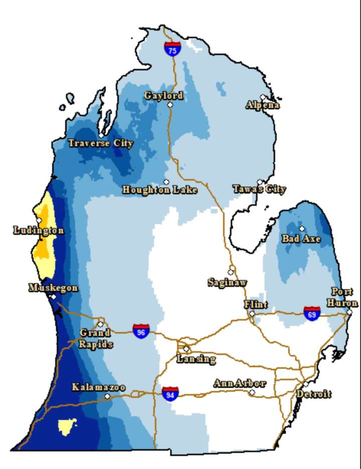
The lake-effect snow will continue today through sunrise Tuesday. The high-impact areas will be relatively isolated, but will occur over a couple of key highway routes in Michigan.
The winter storm warning and the winter weather advisory areas are a good way to see if you’ll run into winter driving conditions.
The lake-effect snow will now hug the west coast of Lower Michigan, and continue at the south end of Lake Michigan.
If you are heading to Chicago from Michigan, you will hit a an area of heavy snow at times in far southwest Lower Michigan and northern Indiana. If you can take I-80 to Chicago instead of I-94, you will avoid some snow. Around the Niles area there could be another 6″-8″ of snow today through tonight.
The heaviest snow is expected in a strong lake-effect snow band th

 Ann Arbor News
 WSIL-TV
 WBRC
WBRC CNN Climate
 NBC News
 KNOE
KNOE FOX Weather
 Hawaii News Now
 KOLO8
KOLO8 21Alive News
 Mediaite