
 KIMT News 3
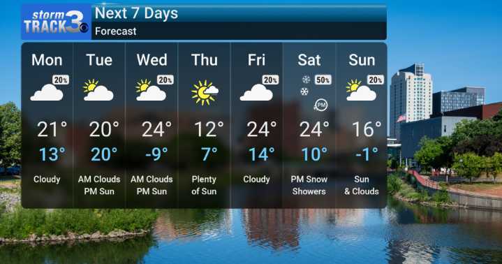
Well folks, it's looking like we're in for a significantly chilly stretch, with temperatures set to be well below normal as we head through the upcoming week. We anticipate below-normal temperatures continuing for quite some time.
The coldest air comes Thursday AM. We are forecasting subzero lows, and when you combine that with the winds, we're talking about wind chills that could easily plunge into the double digits below zero. It’s the kind of cold that demands respect and requires us to be extra careful outside.
Before that extreme cold really sets in, we're keeping an eye on a fast-moving system expected to move through the Midwest on Monday afternoon and evening. This system has the potential to bring us some flurries and light snow. While much of the area will likely just see a dus

 America News
 Daily Voice
 WABI
WABI CBS Minnesota News
 13 On Your Side
 WAND TV
 NBC10 Philadelphia
 New York Post
 The Columbian Sports