
 KWWL
KWWL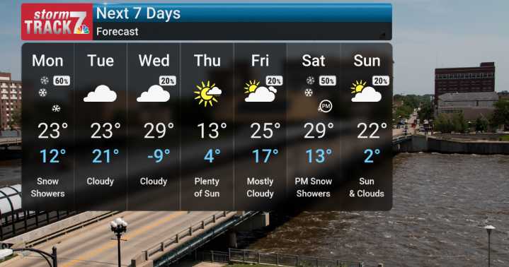
Looking ahead to tomorrow, Monday, we are anticipating another round of snowfall, mainly targeting at least the southern half of the state. This isn't expected to be a major, but we could see accumulations of 2 to 4 inches possible in southern Iowa, with amounts generally around an inch or less farther north (mostly locally). Thankfully, winds are expected to be relatively light with this event.
Beyond Monday, the main weather story through the entire week will be persistent cold. This is cooler than normal weather that will really set in. The coldest temperatures are expected late Wednesday into Thursday morning, when we could see overnight lows dropping below zero, with wind chills potentially reaching the teens and even around twenty degrees below zero.
Highs on Thursday will also be

 America News
 WCBI-TV
 Daily Voice
 WLOX
WLOX WABI
WABI 13 On Your Side
 NBC10 Philadelphia
 CBS Minnesota News
 WAND TV
 KFDA-TV Sports