
 WKYT
WKYT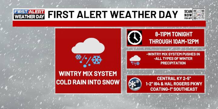
LEXINGTON, Ky. (WKYT) - A winter storm rolls in later today and tonight, kicking off Meteorological Winter with a sloppy mix of snow, sleet, freezing rain and plain rain across Kentucky. Travel conditions will go downhill quickly once this arrives.
A Winter Weather Advisory already covers a good chunk of the state, but the southern edge still looks a little underdone as of this morning. I wouldn’t be surprised to see portions of that expanded or even upgraded later today.
Here’s the breakdown based on the latest snowfall forecast:
Far Northern Kentucky: Generally 1″–4″ of snow , with the higher totals closer to the central/northeastern corridor.
Central/Eastern Kentucky (the main deformation band): A broader 2″–5″ zone , and some sleet or pockets of freezing rain may mix in.
Sou

 WBIR Channel 10
 The Weather Channel
 WKYT Crime
 WSMV 4 Nashville
 Spectrum News Louisville
 LEX 18 News
 AlterNet
 OK Magazine