
 21Alive News
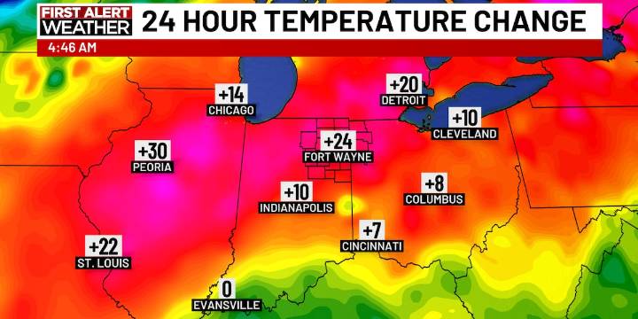
FORT WAYNE, Ind. (WPTA) - After a record cold morning on Friday, temperatures have warmed up, and will be about 30 degrees warmer for the afternoons this weekend. It just won’t be that warm of a weekend, though.
Saturday, expect mostly cloudy conditions and high temperatures in the low 30s. A few very light snow flurries are possible, as well as a patch of freezing drizzle, which could cause a few slick spots on the roads Saturday afternoon.
Sunday morning is when our next weather system will start to move in, bringing us some light snow showers. The weather system in question is expected to loose it’s strength as it gets to us. So, Northeast Indiana and Northwest Ohio might see up to 1″ of snow by the time the snow is done Sunday afternoon. Again, even light snow can cause a icy spots t

 NBC12
NBC12 The Jersey Journal
 The Times of Northwest Indiana Crime
 WTHR
WTHR The Journal Gazette
 WEHT/WTVW
 The Gleaner
 NBC News NFL
 RadarOnline