
 WREX
WREX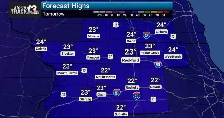
Tonight into Monday morning, there's a possibility for some light snow to develop, particularly in northwest Indiana and northeast Illinois, as drier air filters in behind the clipper. This could result in a dusting to about an inch of additional accumulation in some spots.
Looking ahead to the middle of next week, another system approaches bringing the potential for a wintry mix before transitioning to rain across much of the area. However, temperatures will likely plummet again by Wednesday morning, bringing a renewed chance for gusty snow showers, something we’ll need to watch. Toward the end of the week, we anticipate temperatures trending cooler, with highs dipping back into the teens and 20s, and lows falling into the single digits to lower teens. This cooler trend is certainly not

 Local News in Illinois
 America News
 1011 Now Lincoln
 WCBI-TV
 The Seattle Times
 KSNB Local4 Central Nebraska
 Hawaii News Now
 WWSB
WWSB NBC12
NBC12 New York Post