
 WREX
WREX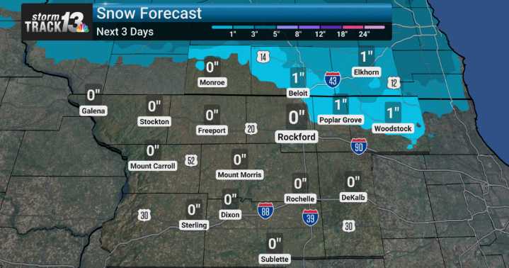
We're starting off the week with chilly readings, but there's a quick warm-up on the horizon. We will be monitoring a system that's expected to bring a mix of rain and snow to the region late Tuesday night into Wednesday.
The latest weather models indicate that ahead of a stronger system moving across Wisconsin Tuesday night, warm air will push temperatures above freezing. This means much of the precipitation we see Tuesday night into Wednesday morning will likely fall as rain, especially in our southern viewing areas.
However, as colder air wraps in behind this system, we expect that rain to transition to snow showers for Wednesday. We are watching the wind potential very closely; some models are hinting at gusts exceeding 40 mph Tuesday night, which would certainly make conditions feel

 CBS 58 News
 WISC-TV Channel 3000
 Local News in Illinois
 America News
 1011 Now Lincoln
 WCBI-TV
 The Seattle Times
 KSNB Local4 Central Nebraska
 Hawaii News Now
 WWSB
WWSB NBC12
NBC12 Raw Story