
 WKYC Cleveland
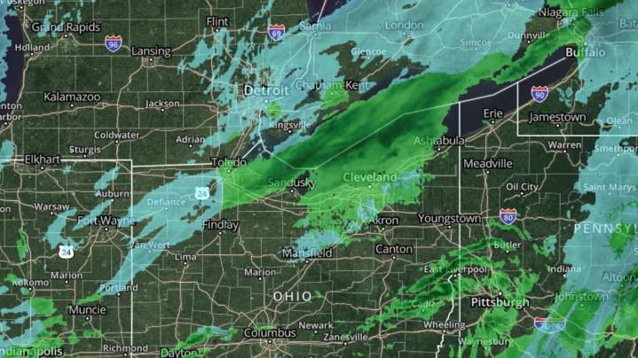
CLEVELAND — On Wednesday morning, Northeast Ohio woke up to a “wintry mix” of rain, snow, and slush that led to messy commutes and prompted a local Weather Impact Alert Day.
Forecasting and preparing for a wintry mix can bring its own challenges. Those challenges are sometimes be compounded by misinformation on radar as the event is happening. This is because radar beams typically scan precipitation thousands of feet above the surface. The height of the radar beam grows with distance. The radar image shows the snow or rain aloft, rather than the shallow layers near the ground.
This matters in a situation like Wednesday because a mix often involves multiple layers:
Snow high aloft
A warmer “melting layer” where snow partially melts into wet flakes or rain
Potentially a cold layer ne

 cleveland.com
 Cleveland Jewish News
 Cleveland 19 News
 NewsBiscuit
 Law & Crime
 AlterNet
 Blaze Media
 New York Magazine Intelligencer
 America News