
 WAAY TV
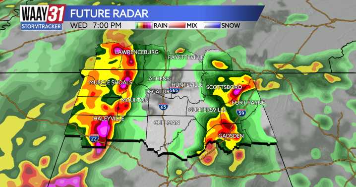
**LEVEL 1/5 SEVERE WEATHER RISK THURSDAY**
Round 1 of rain and strong to severe thunderstorms are currently moving through the Tennessee Valley. This morning's system is mostly just heavy rain with a few thunderstorms embedded within. An increase in the number of scattered storms will take place later this morning and last through the day as we increase daytime heating. This will lead to scattered, hit-or-miss rain and storms throughout the late morning and afternoon.
By this evening, around 6PM, the cold front which will bring the greatest threat for severe weather along its leading edge, will move into the Shoals, it will track east and cross over I-65 by 8pm, and move into Sand Mountain by about 9-10PM. While the greatest severe weather threats will be out of our way by 11PM, isolated

 KICKS 105
 FOX 5 Atlanta Crime
 AccuWeather Severe Weather
 KRIS 6 News Weather
 KPTV Fox 12 Oregon
 KTVU San Francisco
 WFTV Channel 9
 KGNS
KGNS KSNB Local4 Central Nebraska