
 21Alive News
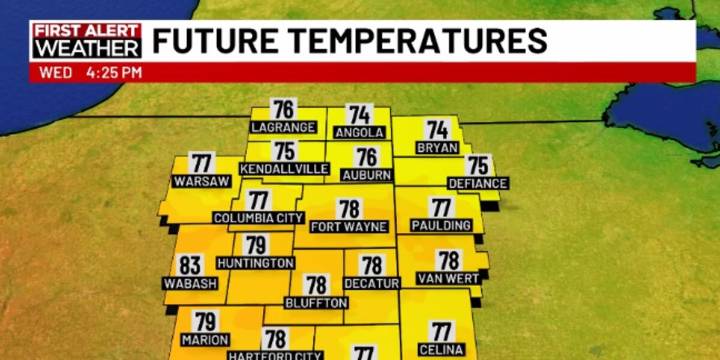
FORT WAYNE, Ind. (WPTA) - Wednesday will be an overall cooler day with highs back into the 70s for much of the area. Overnight lows will also be cooler headed into Thursday morning, dropping into the 40s!
Highs will bounce back into the 80s Friday through the weekend, with mid and possibly upper 80s each afternoon! Humidity will also increase somewhat, making each day feel more like summer than fall.
There are signs this warm pattern will break down in a more noticeable way starting Tuesday of next week as clouds increase and highs return to the mid 70s. Beyond that, we could see a cooler surge of air with a series of fronts, but it’s still a bit too far in the extended forecast range to dissect much further.
For now, summer weather reigns supreme!

 NewsTalk 1280
 IndyStar
 The Journal Gazette
 The Times of Northwest Indiana Crime
 CBS4 Indy
 CNN Politics
 CBS News Video
 WFMJ-TV Entertainment
 AmoMama
 The Daily Beast